Remapping the Llof (Part 1): Basic Geography and Previous World Maps
Something that really bothers me about the state of my world is that I don’t have a good, up-to-date map of it. The most recent map is already eight years old and incomplete, because my approach to drawing it was too perfectionist, and it’s also still based on a map I quickly scribbled down as a kid. I don’t like the islands’ shapes anymore, and it misses crucial changes in the surrounding landmasses that I have since introduced. So a new ongoing non-linguistic project of mine is: To draw a new world map!
Before actually starting with a new map, let’s have a look at my previous attempts and discuss some basic geographical facts about the Llof, the area where my peoples’ main “countries”, the Asiulvesacam and the Cloud Palace, are located.
Historical maps of the Asiulvesacam and the Llof
The whole Llof conworld originates from a role play a couple of friends and I created in high school to pass the time between classes. It was not a D&D kind of role play, but the kids-like “pretend you are someone somewhere else” kind of role play. Initially, we were ash monsters that lived in the sky, walked on clouds, and could transform into anything, eating unsuspecting airplane passengers and teachers we didn’t like. The whole world eventually became more sophisticated and evolved into what it is today. So, one day during a particularly boring physics class, I decided that living on nameless floating islands was not adequate anymore for our ash monsters (aka Asiuluiam), so I took out piece of paper and scribbled the outline of a map onto it. This is the result (leftmost image):
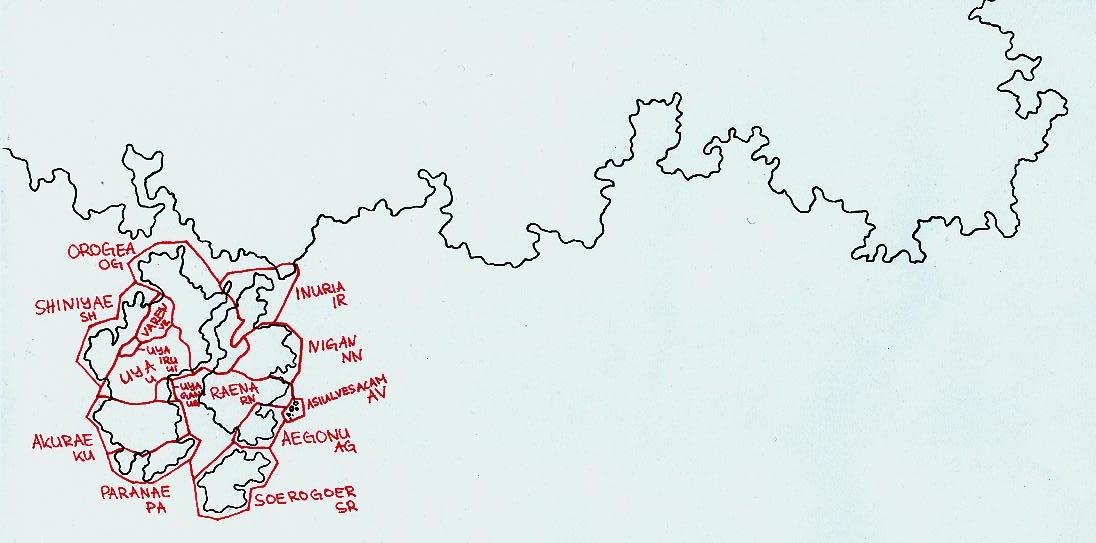
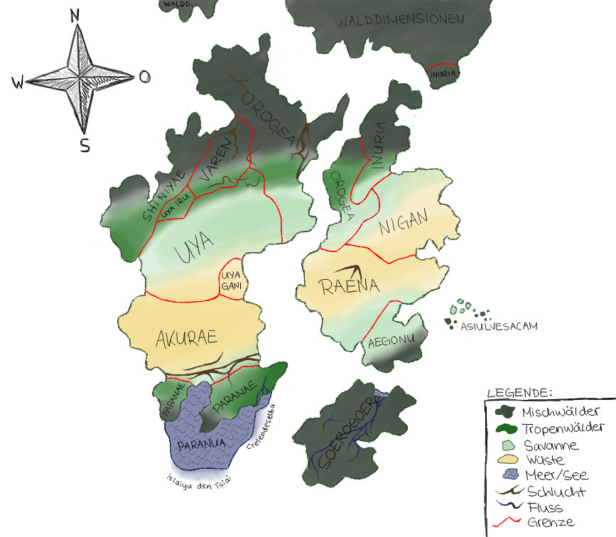
As you can see, the four islands look like they used to be one landmass and were subject to continental drift. I also added some state borders on the islands and named the states with random fantasy names that came to mind. It probably didn’t take me longer than five minutes to draw this, but it is still the basis of the Asiulvesacam map today. On the right is a colored digital version of that original map where I added some canyons and rivers, and color-coded biomes like forests and deserts. With the deserts in the center, it looks like I tried to mimic the climate zones of our Earth.
I also printed out the outlines of the colored map onto eight pieces of paper so that I could stick a gigantic version of it onto the back side of my door. I would then fill the map with details about the landscape, whenever I came up with something for a particular area. I did this in pencil, so that I could erase it again if I didn’t like it anymore. Over time, roughly half of the map was filled with little mountains, trees, river, cities and notes, before I abandoned the project.
Interdimensional Nonsense
In the colored version of the 2009 map, we can see that the large landmass “north” of the Asiulvesacam is called the Forest Dimensions (ger. “Walddimensionen”). Dimensions are a core concept of my world’s geography, but they have nothing to do with what the word “dimension” actually means, since high-school me used the term only because it sounded cool and scientific. A more proper label would be something like “mini-world” – because that’s what they are: Little worlds that you can (physically) access with the power of imagination, or by means of connections between those worlds, named dimension doors or dimension crossings. You can read more about dimensions on this page.
For the purpose of this article, it is sufficient to know that the Llof has connections to several of these dimensions, the most obvious one being the Forest Dimension: A large forested island in direct vicinity of the Asiulvesacam. We also have the Ocean Dimension in plain sight: Through the clouds you can see that the ground below the floating islands is completely covered by water. To the “east” of the Asiulvesacam, not shown on the maps, is the Cloud Palace inside its Cloud Dimension, and even further to the “east”, the Mountain Dimension (full of tall mountains) and Air Dimension (on the peaks of those mountains). In the sky, you can see a nearby sun and faraway stars – they all reside in the Star Dimension. Finally, there are several other dimensions not directly connected to the Llof, but accessible via, for example, the Forest Dimension. Those are – you might have guessed it – the Desert, Savanna, and Swamp Dimensions. Unsurprisingly, I played a lot of Minecraft during the time I made these biomes/dimensions up.
When my world building started to become more serious, I began to ask the inevitable questions about dimensions: What are their boundaries – where do they begin and where do they end? What happens if you cross their boundaries without exiting them into another dimension? What happens if you dig a very deep hole? Do you eventually fall out? What happens if you fly high enough into the air? Do you always arrive in the Star Dimension? Do dimensions have an atmosphere? Do all dimensions have the same sun? Does that mean they are close together in space? Do they have a location in space? Is it the same space the Earth is in? Could humans without imagination physically travel to the Llof then? If the clouds on the Llof plane are solid enough to walk on them, why don’t they fall into the Ocean Dimension? The magic faded and my struggle for good explanations began.
Modern Llof geography
The following model is not really a “good explanation”, but it’s what I have come up with so far and what I currently assume about this world. Have a look at this doodle illustrating the general architecture of the Llof:
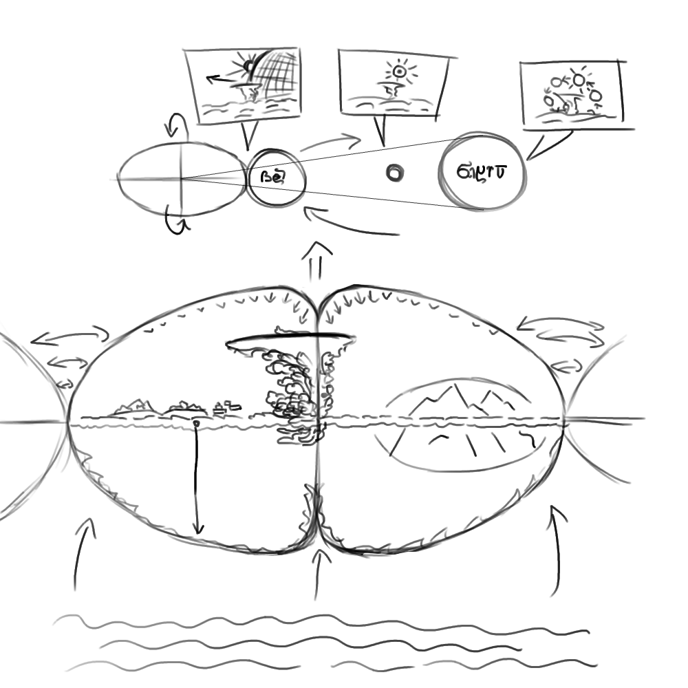
The big elliptic bubble is the Llof. We can see that there is a horizontal plane going through the middle: The Cloud Plane with the Asiulvesacam to the left and the big Cloud Palace in the center. Right of the Cloud Palace, there is a dimension crossing to the Mountain Dimension, looking like mountain peaks breaking through the clouds there. The Cloud Plane is sitting on a zero-gravity zone that allows the Asiulvesacam to float and the cloud fungi (the clouds you can walk on) to grow there without falling down. The vertical axis of the Llof might also be a zero-gravity zone – either only in the past or still today – or have some other features that support a huge unstable structure like the Cloud Palace.
The Llof’s boundaries are generally connected to their opposite counterparts: When you walk “west” from the Asiulvesacam, you will eventually find yourself “east” of the Cloud Palace. When you go up, gravity gradually increases until it’s impossible to rise further. This is to keep the inhabitants of the Llof from going into space, because that’s a scenario I’m not yet ready to support. When you go downwards past the Cloud Plane, you enter the Ocean Dimension. The Ocean Dimension itself is flat – but the dimensional boundaries of the Llof are curved, lending the Ocean Dimension a pincushion distortion effect when viewed from the Cloud Plane.
The upper half of the Llof and the right tip show the Star Dimension. Towards the right, visibility of the Ocean Dimension starts to fade. The ocean becomes transparent and the Star Dimension is starting to show through. View of the Star Dimension is not distorted – rather, the Llof seems to be embedded inside the Star Dimension. It is apparently located inside a solar system, with the system’s star (Siancra, after the Dakiuzuiam’s main deity) to the “east” of it (see upper part of the image above). Since the Llof is not a celestial body itself, but only has a huge dimension crossing to the Star Dimension, it has no orbit around its sun, but “rotates” around its own horizontal axis at a slight angle. The rotation is not smooth; it is actually a series of repeating shifts of the dimensional crossing. The result is that Siancra “jumps” across the Llof’s “sky” in a rough circle, dipping shortly below the Cloud Plane during the course of the day, giving the Llof’s inhabitants a brief night in dim light.
There are some actual planets rotating around this sun, two of which have orbits that go between Siancra and the Llof. The closer one, a big blue planet (Kabuki, after the Asiuluiam’s main deity), passes so closely to the Llof that it has tidal effects on the Asiulvesacam’s bodies of waters for a few months each year. It also causes a solar eclipse for the Llof that lasts several days and marks the beginning of a new year for its inhabitants.
The fate of the Forest Dimension is not yet decided, but I’m currently leaning towards removing it from the Cloud Plane and placing it as an island into the Ocean Dimension, letting the Ocean dimension also (partially) cover the upper left part of the Llof’s “shell”. This would make for a cool upside-down floating island in the sky when standing on the Asiulvesacam.
My latest attempt at a map of the Asiulvesacam
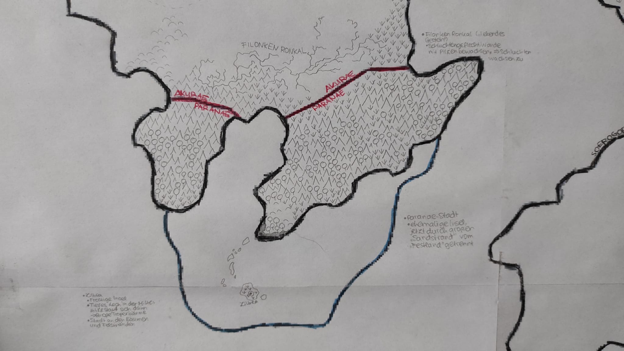
In 2016, I was writing the second version of my Ryka Grammar, and I wanted to include a map of the Asiulvesacam in it. However, the most recent (digital) version of the map was still the biome-colored map from 2010, which didn’t even feature any cities. So I sat down to draw an updated version of the map, and this time, I wanted to get it right.
The islands on the original map were already looking as if they had once been a single island and were then separated via continental drift. There is no plate tectonics on a cloud plane, obviously, but the island could still have drifted apart by other means – either by movement of the cloud plane itself or by some dimensional stuff happening. Thus, I started out by drawing the original “continent”, roughly following the shapes of the original two islands from the 2009 map moved close together. I freestyled the Soerogoer island, whose previous shape I had never really liked. Then, I moved the three islands apart and arrived at some pretty outlines for my new map. Finally, I chewed away some of the shared coastlines and added some floating mini islands to emulate some erosion.
Now the real work began: Drawing the topography. Without the plate tectonics that you have on an actual planet, I had to find another way to create mountain ridges. My explanation were wind canals, cavities formed on the underside of the islands in the paths of strong wind currents blowing across the cloud plane. On the walls of these wind canals, cloud fungi spores would get caught, grow, and petrify, eventually pushing the surface up to form mountains. All of the mountains were thus filled with petrified cloud fungi, and many of them were hollow, allowing them to fill up with moisture from the clouds underneath, turning them into cloud wells that could feed rivers (see “Cloud Wells” on Asiulvesacam).
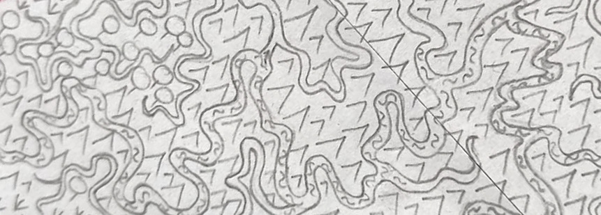
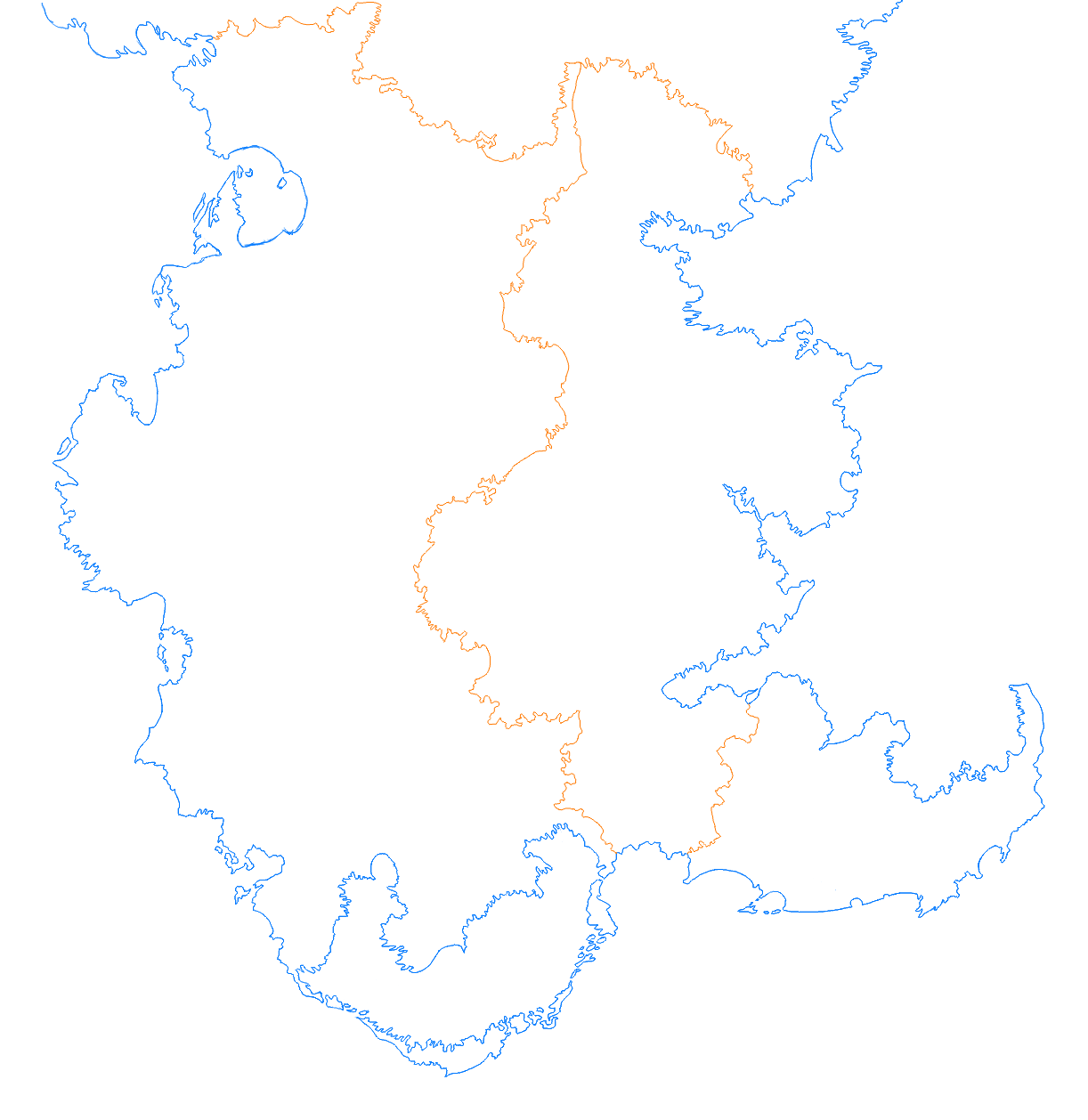
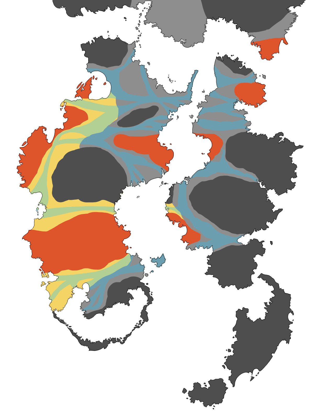
So to start with the topography, I marked the different rock types that the islands consisted of on the map. To be honest: I don’t know a thing about rocks, so please don’t try to map these to any existing rocks/minerals. I decided to have four main rock types that would also affect the color of the ground in these parts: Black rock (very hard), grey rock (softer), red rock (also rather hard), and ochre rock (very soft). The hardness of these different rock types affected the formation of wind canals, since the cloud plane’s winds were only able to wash out the softer rock types. You can see my sketch of the rock types and wind canals in the first image below.
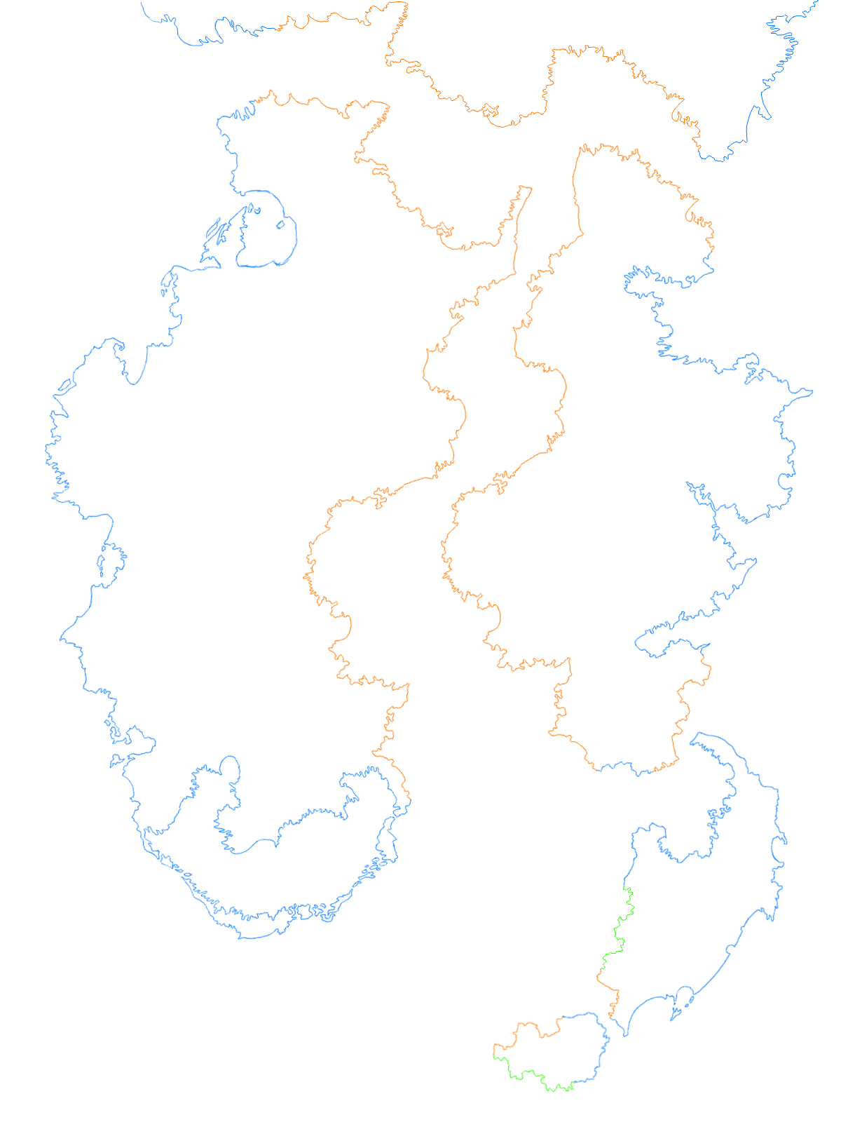
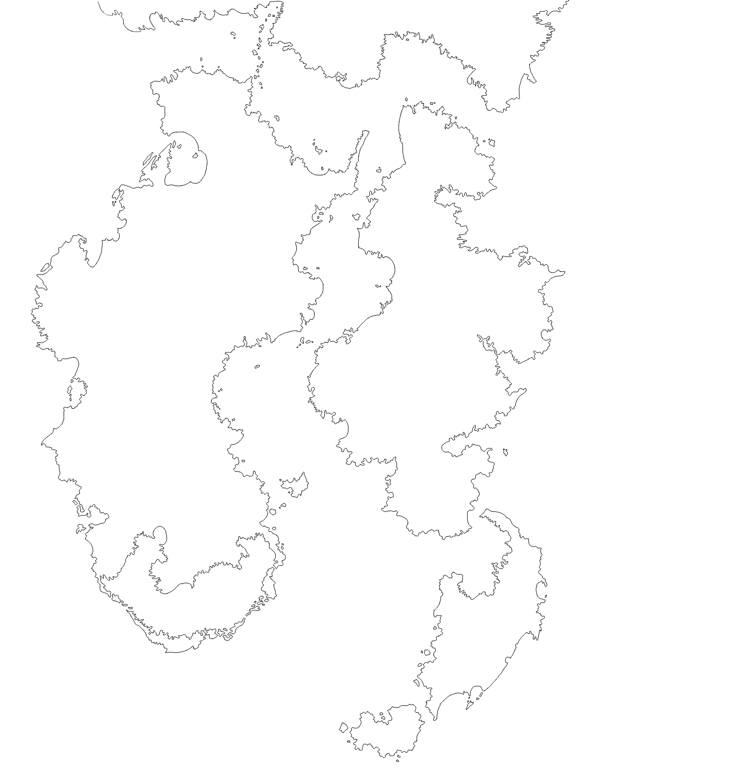
I then started adding the topographic layers on top of the wind canals. I drew them in greyscale, so that I could later apply different color schemes to them. It was during this phase that the progress on my map stalled, because drawling ten layers of mountains was really tedious and my perfectionism was getting in the way. I stopped working on it for some time and finally finished the raw mountains in 2017. By 2018, I had managed to add rivers. In 2021, I added the erosion from the rivers to the topographic shapes. Earlier this year, I finally declared the project dead and added city names to at least be able to use the unfinished map for display on this site. You can see the final result here (second image):
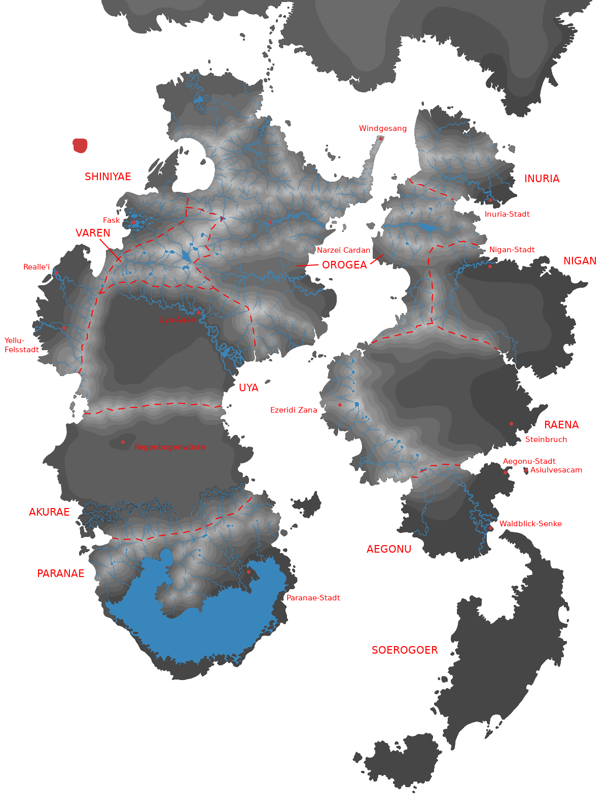
The map has actually already progressed quite far – missing are only terrain and colors. However, between 2016 and 2024, my idea of what the Llof should look like had changed quite a bit, as outlined above, and I also wanted to include the Isle of the Free Yelluam and the farming world of the Cloud Palace in the final map. Also, I wasn’t happy with the placement of the Asiulvesacam themselves anymore – they look like they are designed to nicely fill out an A4 piece of paper, which will look odd if I extend the canvas to add the islands of the Yelluam and Dakiuzuiam.
Finally, the orientation of the islands on the map makes no sense. Since they are not on a planet’s surface, we do not have the four cardinal directions north, south, east, and west on the Llof (which is why I put them in quotes during the entire post). Instead, the most prominent orientation point is the sun, and thus, the main direction on the Llof (the equivalent of “north” on Earth) should be “sunwards”. This makes me think that my previous maps should better have been rotated 90° anti-clockwise, so that the “sunwards” direction is towards the top.
Outlook
Here we go again: A new map of the Asiulvesacam, or rather, the first map of the whole Llof is due. I am probably going to reuse the shapes of the 2016 map, but I will change several things about the map and the process of making it:
- Inclusion of the Isle of the Free Yelluam, the Dakiuzen islands and the island of the original Quriil speakers; removal of the Forest Dimension continent.
- Placement of the Asiulvesacam: As mentioned above, I’m not happy with how the two main islands look next to each other. I will try to rotate and move them around more, maybe even let them crash into each other.
- Less perfectionism. The map doesn’t have to look like it belongs into a real-world atlas. I just want a map that represents the current state of my world building. Maybe try a less realistic, more fantasy map-like approach: Instead of drawing ten layers of topography, use little symbols to denote mountains and forests, as in the pencil drawings on the back of my childhood room door?
So, let’s see how this goes and how long it takes this time – can I beat the eight years of the previous attempt? 😀